Baltsavias E.P., Favey E., Bauder A., Boesch H., Pateraki M., 2001. Digital surface modelling by airborne laser scanning and digital photogrammetry for glacier monitoring. Invited paper at Annual General Meeting of the Photogrammetric Society, UK. In: Photogrammetric Record, 17(98): 243-273. [doi] [pdf] [bib]
Abstract:
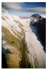
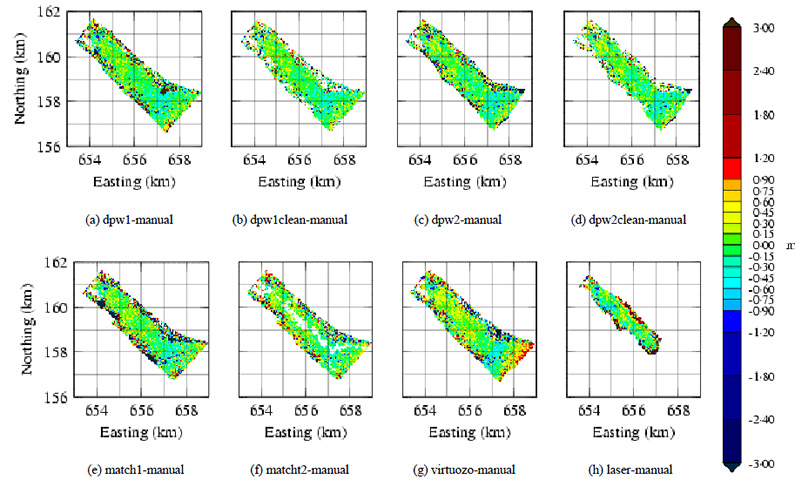
This research is part of a Swiss National Science Foundation project on “Mass Balance Determination of Glaciers with the Use of State-of-the-art Remote Sensing Methods and a Numerical Flow Model”. Remote sensing involves automated processing of aerial images and laser scanning and aims at producing glacier surface models with an accuracy of about 0·5-1 m in time periods of 1-5 years. The Unteraar glacier, Switzerland, has been chosen to test both methods, as it has been extensively studied by glaciologists. The results of laser and digital photogrammetry were evaluated using accurate manual measurements at an analytical plotter. Regarding laser data processing, different aspects like system description, position and attitude determination, transformation to the Swiss map co-ordinate system, fit of overlapping laser strips and problems encountered are presented. Three digital photogrammetric systems (Match-T, LHS DPW770 and VirtuoZo) were used for surface model generation using image matching. The different matching algorithms and strategies, occurred matching problems due to low texture, shadows, steep slopes etc. and a quantitative and qualitative evaluation of the results are presented. Finally, a comparison between photogrammetry and laser scanning regarding accuracy and point density is presented.
 |
 |