Author Archives: mpateraki

Das Potenzial von Ikonos- und Quickbird-Bildern fuer die genaue 3D-Punktbestimmung, Orthophoto und DSM-Generierung

Eisenbeiss H., Baltsavias E., Pateraki M., Zhang L., Gut O., Heller O., 2004. Das Potenzial von Ikonos- und Quickbird-Bildern fuer die genaue 3D-Punktbestimmung, Orthophoto und DSM-Generierung. Geomatik Schweiz, (9), pp. 556-562. [pdf] [bib] (in German) Zusammenfassung: Am Institut für Geodäsie und Photogrammetrie der ETH Zürich wurden hochauflösende Satellitenbilder (Ikonos, Quickbird) im Hinblick auf die geometrische Genauigkeit für die Bestimmung […]
Posted in Publications | Comments closed

Orthophoto Generation Using Ikonos Imagery and High Resolution DEM: Study Case on Volcanic Hazard Monitoring of Nisyros Island (Greece)

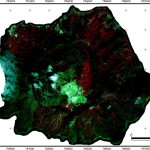
Vassilopoulou S., Hurni L., Dietrich V., Baltsavias E., Pateraki M., Lagios E., Parcharidis I., 2002. Orthophoto Generation Using Ikonos Imagery and High Resolution DEM: Study Case on Volcanic Hazard Monitoring of Nisyros Island (Greece). ISPRS Journal of Photogrammetry and Remote Sensing, 57(1-2), pp. 24-38. [doi] [pdf] [bib] Abstract: Georeferenced high-resolution satellite images can be used […]

Posted in Publications | Comments closed

Digital surface modelling by airborne laser scanning and digital photogrammetry for glacier monitoring

Baltsavias E.P., Favey E., Bauder A., Boesch H., Pateraki M., 2001. Digital surface modelling by airborne laser scanning and digital photogrammetry for glacier monitoring. Invited paper at Annual General Meeting of the Photogrammetric Society, UK. In: Photogrammetric Record, 17(98): 243-273.  [doi] [pdf] [bib] Abstract: This research is part of a Swiss National Science Foundation project […]

Posted in Publications | Comments closed